Every Trip, Marked With Exactly Where You Were
Where you were, how high up, and which way you were facing — stamped directly onto the photo, not buried in metadata that gets stripped the moment you share it.
Camera, location, and stamp settings all stay on your device.
A running record of the trail
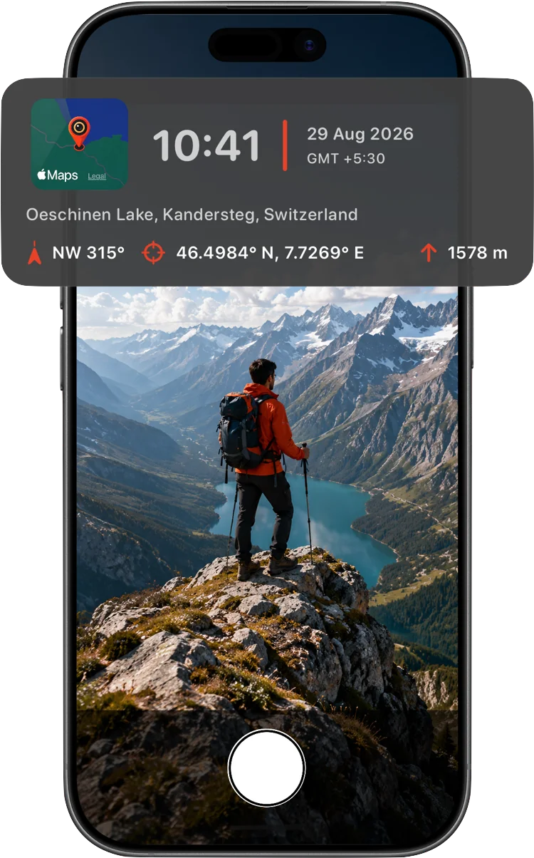
Keep track of a trip or hike as it happens — where you were, how high up, and which direction you were facing, on every photo, with a single tap.
- GPS coordinates in your preferred format
- Altitude in meters or feet
- Live compass heading with true or magnetic north
- Small map thumbnail pinned to the exact capture point

Add the story behind the photo
A short note field sits right alongside the date, time, and place — the difference between a photo that shows a moment and one that explains it, months later when the memory's faded.
- Optional note field for context only you can add
- Drag, resize, and reposition the stamp anywhere on the frame
- Clean, legible design that never overwhelms the photo
Frequently asked questions
Does it work with no signal, deep in the backcountry?
Yes. Time, GPS coordinates, altitude, and compass heading all work fully offline. The optional street-address line needs a network connection to resolve — if you're offline, that field is simply left off until you're back in range.
Will people see exactly where I was if I post the photo?
Yes — that's the point of a visible stamp. The location is burned into the image itself, so anyone who sees the photo can see where it was taken. Worth keeping in mind before posting a stamped photo publicly, or turning off coordinates for casual shots.
Does it drain the battery tracking location constantly?
No. Location is only read while the camera screen is actually open, not in the background — the same behavior as your iPhone's own Camera app.
Does it work on video too?
Yes. The same location and time stamp burns live into recorded video, not just still photos.